
NEED HELP? ONE CALL AWAY, 24 HOURS A DAY 946-7777


GEOGRAPHIC INFORMATION SYSTEM
The Space Management Team maintains an enterprise-level Geographic Information System (GIS) of spatially referenced data. This GIS is used to support Facilities Services primary mission, as well as supporting the data needs of other departments across campus. This includes the collection, creation, and maintenance of spatial information pertaining to all assets on campus, and providing cartographic services for all University faculty, staff, and students.
We are responsible for ensuring that the UTK base maps, utilities, and other critical datasets are maintained and accurate. We provide custom mapping applications, systems, and tools that rely on this geospatial information in order to support units within Facilities Services and other departments throughout the University of Tennessee. We also offer a variety of printable maps created from this collected data.
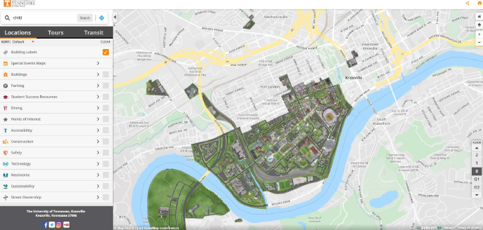
Additionally, the data we maintain and collect is used to support our interactive Campus Map. This is an interactive web-based GIS mapping application containing information on a variety of valuable resources available on campus, such as building information, parking designations, and accessibility to name a few. This tool is available to students, faculty, staff, and visitors.